 |
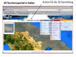
Basis of this information system for demonstrating environment impacts is a standard GIS application from ESRI based technology.
The outcome of an analysis will be disclosed on traditional maps. In addition to that the results can be visualized in 3D due to the integration of the 3D viewer BS Contact . Thus the user can watch the results which has been valuated in a GIS interactively and can also interprete the outcome accordingly.